Pedestrian Routes to Schools/Green Infrastructure Project Begins 6-8-2020
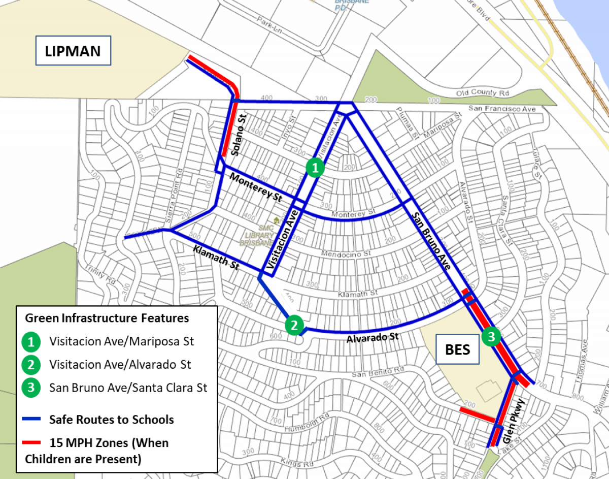
The City of Brisbane will be making street improvements along the Pedestrian or Walk Routes to Schools, which are designated sidewalk routes between Brisbane Elementary School and Lipman Middle School. At the three intersections shown above, the City of Brisbane will be installing green  infrastructure (GI) bioretention basins, which capture and treat stormwater, next to the sidewalks and integrating them with curb ramp “bulb-outs.” Other improvements in some areas along the Walk Routes will include new sidewalk extensions, curb ramps, crosswalks, and striping modifications. On street segments near the schools, a new 15 MPH speed limit will be in effect while children are present. Keep an eye out for the blue and gold-colored medallion markers which will be placed on the sidewalk to mark the Walk Routes (the one pictured here is a depiction of their design only).
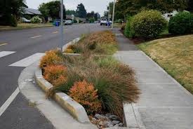
To the left is an example of the green infrastructure bioretention features that will be installed at the three intersections shown below on the map above. The project is partially funded by a grant from City/County Association of Governments of San Mateo County (C/CAG).
The City’s contractor, Kingdom Pipelines Inc., will be starting construction on June 8, and the project will last approximately two months. Working hours will be from 8am - 5pm from Monday to Friday. There will be no road closures, but please be aware of traffic control measures and parking restrictions in the vicinity. For more information, please contact Justin Yuen at jyuen@brisbaneca.org. Thank you for your cooperation as we move forward with this project to enhance both walking conditions and improve stormwater quality.